Strato
Software for land survey and road design
Strato works in different application areas: land survey, road, railways and tunnel design.
Strato is a BIM software, wich works with format IFC.
SURVEYS FROM GPS OR TOTAL STATION
Strato® calculates and compensates polygons with empirical and rigorous compensation, even with multiple reading layers.
The DTM calculation is with triangular mesh, the extraction of profiles and sections of the ground is included. Volumes are calculated with indication of excavation and embankment areas.


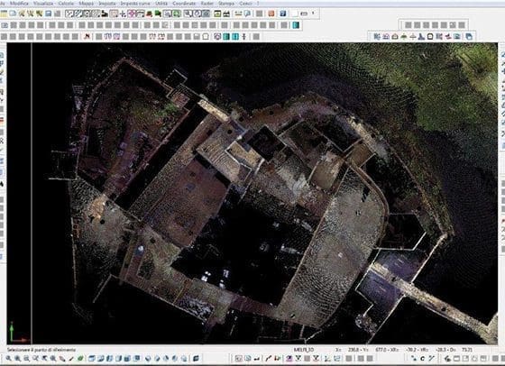
PHOTOGRAMMETRY AND POINT CLOUDS
With Photogrammetry module it is possible to generate point clouds directly from photos taken with drones.
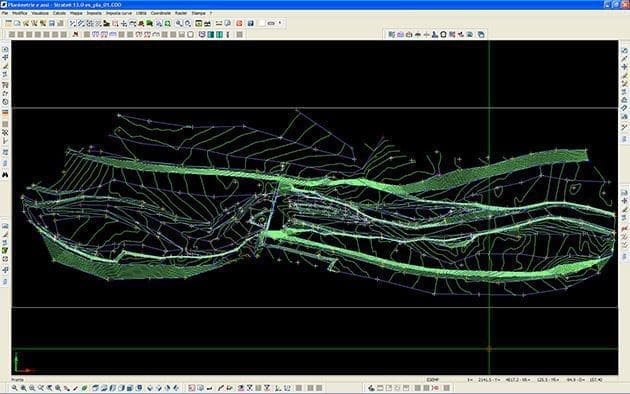
Strato is able to process over 2 billion points detected with both drones and laser scanners, using files in standard .las or ASCII format. It is possible to define an import offset to speed up all subsequent operations. On the calculated DTM it is possible to insert breaklines created graphically using also orthophotos.
Strato is the ultimate software solution for land survey with drone, find out all the details on the Photogrammetry module.
3 VERSIONS FOR ROAD DESIGN
Namirial Strato provides three versions for road design, identical in terms of functionality and calculation, different for the number of design axes: up to 2 axes, up to 7 axes, without limits.
You can choose the best configuration for your project.


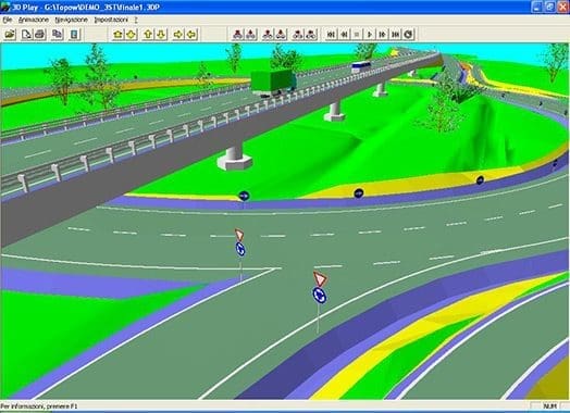
ROAD DESIGN
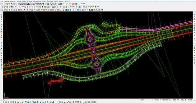
With Strato software it’s possible to create the planimetric and altimetric project, to define tcross and accounting sections, with immediate control of legislation.
It’s possible to automatically check the lengths of straights, cloth-like fittings, widenings, etc. There is also a three-dimensional project simulation.
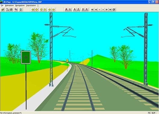
RAILWAY DESIGN
Strato is the railway design software for low and high speed. Profiles and sections can be single or double track and kinematic verification is included.
Particular functions are foreseen for rectification of existing railway lines.


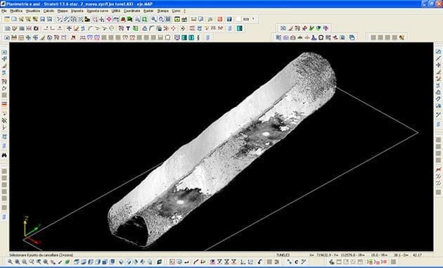
ADDITIONAL MODULES
Strato provides additional modules for the design of leveling, quarries and landfills, and for tunnel design.
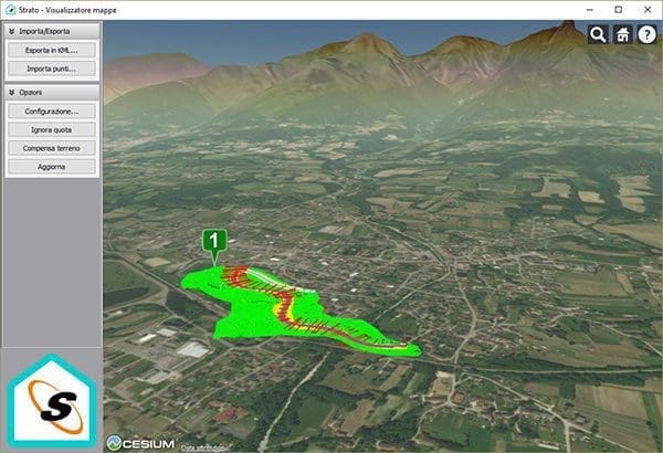
BIM SOFTWARE
Strato® works in BIM mode by exporting all its final drawings (DTM, 3D terrain model, road construction elements) in IFC format.
The BIM mode is in fact already included in all program configurations, it is not necessary to purchase dedicated applications.

- Mathematical model of the terrain: The calculation of the mathematical model of the soil is knitted triangular with different algorithms for topography surveys, aerial, for sections and with laser scanners. You can choose how you want to insert the lines of discontinuity: manually (by selecting the point to point ), semi-automatic (search for points with the same code), fully automatic.
- Extraction of profiles and sections: Automatic extraction of profiles and sections from the terrain model. Sections and profiles can be obtained by just measuring points without using the mathematical model: Strato® also provides the ability to align the refernce points on the reference line.
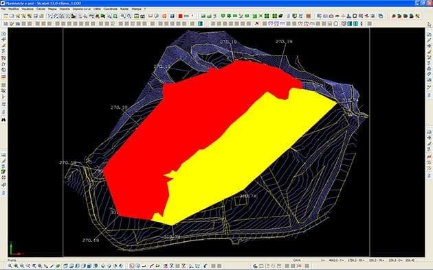
- Calculation of volumes: A specific print report lists in detail the planimetric coordinates and the height difference of prisms, justifying the result obtained. This guarantees the highest accuracy possible. Is also possible to obtain the planimetry with defined areas of excavation detected.
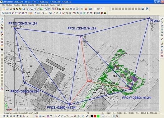
- Polygonal: Strato® processes all planimetric measurements or plano elevation performed by polygon, trilateration, leveling. In addition, corrects them for terrestrial sphericity, refraction or projection on a reference plane. For each station you can perform multiple layers of measures with automatic reduction to a single average reading.
- Least Squares: The compensation is rigorous with the method of least squares. In addition, the program allows you to store the history of processing multiple surveys for the subsequent numerical and graphical representation of the deviations plano altimetric.
- Cadastral survey: You can elaborate format cadastral surveys planimetric, plano altimetric, in rectangular coordinates. Strato® allows you, through rototranslation interactive or automatic, to orient or relocate the type of map in any reference system: in this way, if you use transparency in a raster image and/or vector, you can obtain the exact ovelapping of the drawings.
- The design of the leveling is done directly on the terrain model and it is totally interactive; positioning takes place with the setting of the heights on three points or by the height of two points and the gradient of third. The calculation of the intersection of the planes on the escarpment of the terrain model (contour leveling) is automatic. The three-dimensional representation of the project is immediate, fully interactive and easy to make.
Free software for Italian Land Register – Strato Driver Catasto